Geo Location Finder Air App
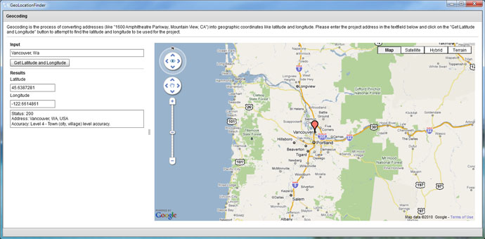
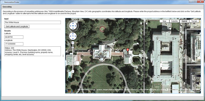
This is a nifty little AIR application we whipped up to reverse geocode landmarks and addresses to get their latitude and longitude coordinates. We had previously been creating this functionality in web pages when needed, but thought it would be nice to create a portable and lightweight desktop version. The application was literally created in a few hours with the Flex framework, Flash Develop and the Google Maps Flash API. Since it is an AIR application, it can run on Windows, Linux, and Mac. We plan on open sourcing this little app in the future, so that anyone can use it…it’s on the todo list.
May 2010